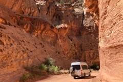
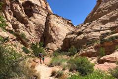
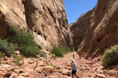
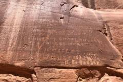
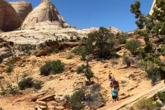
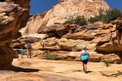
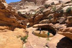
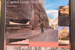
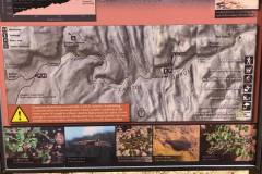
In the course of just one mile, the trail passes a petroglyph panel, several hundred historic signatures, a small natural arch and a sequence of water-filled potholes, and a narrow, rocky side canyon that also has potholes, and dryfalls.
We have attempted this trail twice. Once was when the kids were younger and it was\
LENGTH:
- 2 MILES –
- ALLOT AROUND 1.5 HOURS
TRAIL DETAILS:
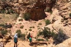
The parking lot at the end of the road is often quite crowded; arrive early or late in the day to secure a spot. Two trails take off from the Capitol Gorge Trailhead: a steep, moderately strenuous climb to a viewpoint of the Golden Throne and the easy stroll through the gorge. The Capitol Gorge hike begins at the covered picnic area at the road’s terminus and strikes out east into the slender canyon.
Follow the wide and sandy track for around ¼ mile the trail does indeed drop into the wash bottom, where most of the remainder of the hike will stay. Scan the right-hand wall for a peculiar sight of the Pioneer Register of a jumble of names and dates. From here, Capitol Wash slices through the Navajo sandstone, carving a canyon that thins to as little as 15-20 feet wide in several places. The etchings continue—and pick up in frequency—as hikers approach the Pioneer Register, a jumble of names and dates on the left-hand wall roughly 6/10 mile from the trailhead.
After the register, two minor ravines enter from the left and right, followed within minutes by another pair of larger side canyons. To the north is Tanks Draw, which hosts a series of waterpockets accessible by a short spur trail.
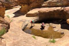
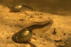
The side trip to the Tanks is well-marked and begins approximately 8/10 mile from the trailhead. The trail is rocky and rugged and climbs more than 100 feet over the course of ¼ mile, ending at an attractive drainage boasting—at most times—a half-dozen potholes full of water. The Tanks support one of Capitol Reef’s most interesting microenvironments—check for tadpoles and fairy shrimp, as well as lichens and mosses. The kids loved them and didn’t want to leave! However, when we were there their was only 1 tank with water and it barley had any. Somehow there were tadpoles still living and flourishing in it!
LOCATION
From the Visitor Center, drive south on the Scenic Drive for eight miles, turning left onto the unpaved Capitol Gorge Road. There are spectacular views from the road itself as it hugs the canyon walls.
GPS COORDINATES
- 38.2095986, -111.1694514
GEAR CLOTHING WE NEEDED
With climbing up and down on sandstone it’s best to have good grip hiking shoes or sandals. Here are our favorites.
During those warm summer months just make sure to bring sun screen, a hat, and always extra water. We always like our Days packs with our hydration bladder. Here are a few of our favorites.
CAPITOL REEF GALLERY
FUN FACT:
On the walls before the Pioneer Register are the names of six surveyors near the top of the vertical face—Stewart, Stewart, Hayes, Hurst, Ollrton, Gifford—and the date: September 24, 1911. How—and why—did these adventurous contractors carve their names so high up the canyon wall? The story told today involves what amounted to a pioneer prank. The six contractors conceived an idea: lower one of the members down from the top in a bucket to carve the names, then return a few years later with their families, to whom they would explain with astonishment—lying that they once etched the names standing in the wash bottom—“look at how much the canyon has eroded!” Whether the trick achieved its desired effect remains a mystery.
BACK TO:

Click here to return to our Complete Guide to Capitol Reef National Park


