CATHEDRAL VALLEY

CATHEDRAL VALLEY

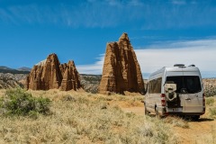
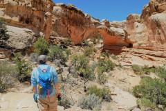
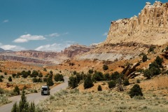
A 57 mile dirt road at the northern end of the park where enormous monoliths soar hundreds of feet high. It’s a vast adventure with a remote one of a kind beauty.

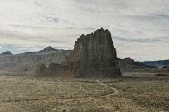
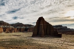
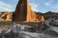
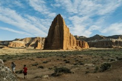
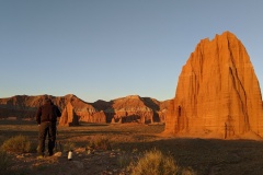
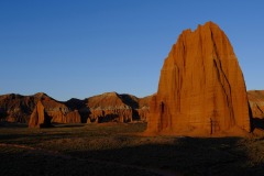
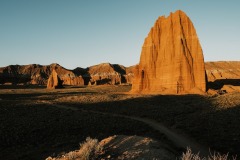
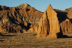
You could do this full drive in a day for sure, however that puts you seeing Temple of the Sun and Moon right in the middle of the day. The sun is bright and it gives the Monoliths a cool, but dull overall color. If you choose to wild camp… you get to view them in all their glory. They glow at sunset and and they are on fire at sunrise. If you’re not a wild camper, make an exception just this one time. Get a little uncomfortable for a night. This is a time that it will be all worth it.

They are cool to see in the middle day sun, but when they’re glowing and on fire, they’re unforgettable.

MIDDAY – SUNSET – SUNRISE

It was amazing to witness. I’ve never seen a rock formation be able to take on so many different colors in light. Even watching the sun set and rise you could constantly see the colors changing every minute. Take a look at our gallery below to view all the colors it turned. We edited with keeping its true tones. It was so beautiful.

SCENIC STOPS:

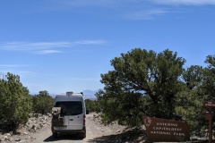
The Entrance: This might be little but this was big to us. There aren’t a lot of National Park Entrances that are a dirt road. We appreciated this and loved every minute of it.

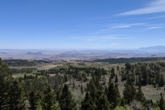
THE OVERLOOK: Take in the vastness of what Capitol Reef really is about. This is just ONE section of Capitol Reef. There is so much more to explore. Take it in, and make plans to come back.

TEMPLE OF THE STARS: Shortly after the Campground you will descend down the steep portion of the overlook and down into some beautiful monoliths! At first we thought these were temple of the sun and moon, but turns out we were wrong. However, still beautiful to behold.

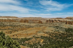
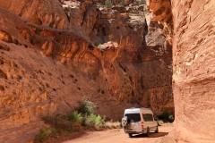
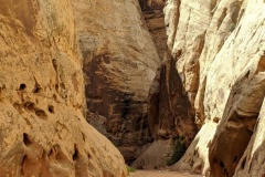
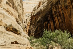
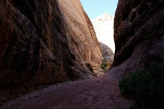
WALLS OF FINS: Take in the beauty of this beautiful drive, with its thin fluted walls.

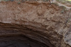
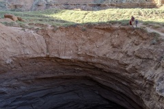
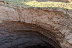
GYPSUM SINKHOLE: This 200′ deep and almost 50′ wide sinkhole is worth a visit but hard to photograph.  I tried my best.

LOWER CATHEDRAL VALLEY: A MUST DO. Why go here without seeing the best part? Again, please stay until sunset or wake up at sunrise. Worth every minute. What you’ll find there:

  • TEMPLE OF THE SUN
  • TEMPLE OF THE MOON
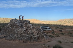
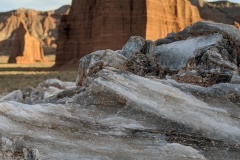
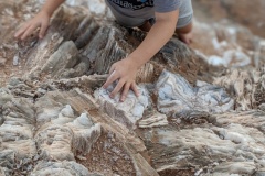
  • GLASS MOUNTAIN: Glass mountain was the coolest of the 3 even though its only about 12ft high. Not really a mountain but we did climb to the top and act like it was! It was beautiful and so unique. Remember, resist the urge to take anything. You’re in a national park. Along the Road to Temple of the Sun and Moon follow the sign to the right that directions you to glass mountain. They’re all very close together.

HIKING ROUTES: There are also hikes you can do, unfortunately we didn’t do any on our visit. Take look here and it will give you more details: HIKING ROUTES

CAMPGROUNDS:

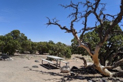
  • The Cathedral Valley Campground is a primitive campground with 6 sites. We heard it is hardly ever full, so there is a good chance you can get a spot. The best part is that this campground is fee to those who are up for the adventure.
  • There are around 10 pull offs along the way that you can stay at along the road if you wanted to wild camp.
  • WILD CAMPGROUNDS: There are also 2 larger group wild camping stops closer to The Temple of the Sun and Moon. The closest one that we stayed at is located at 38.458, -111.180 You can see the very tip of the Temple of the Sun. We also had the place to ourselves. At sunset and sunrise. We couldn’t believe it!

LENGTH:

  • 57.6 MILES OR WHENEVER YOU WANT TO TURN AROUND.
  • ALLOT AROUND 6-8 HOURS
Distances from Highway 24 starting on the Hartnet Road (traveling clockwise)
  • Hwy 24 junction to Lower South Desert Overlook – 15.2 miles
  • Hwy 24 junction to Upper South Desert Overlook- 27.2 miles
  • Hwy 24 junction to Cathedral Road Junction- 27.8 miles
  • Hwy 24 junction to Cathedral Valley Campground- 28.1 miles
  • Hwy 24 junction back to Hwy 24 via Cathedral Rd 57.6 miles

TRAVEL DETAILS:

This driving loop takes about 6-8 hours to complete. Most visitors to Cathedral Valley drive the 57.6 mile (92.7 km) loop clockwise, beginning on the Hartnet Road located 11.7 miles (18.8 km) east of the visitor center on Highway 24 and continuing on that for 27.8 miles (44.7 km) to Hartnet Junction. Turn right (north) onto Cathedral Road and driving 29.9 miles (48.0 km) back to Highway 24 will complete the loop. 

We want to first say that you do need a high clearance vehicle if you are going when the Harnett Road River Fjord is high and you have to cross. However, you don’t have to go that way if you don’t have a high clearance vehicle. You can start on the Cathedral Road crossing near Caineville, drive to the Sun and Moon, and then just turn around the way you came. That would be totally worth it and not too long of a drive either. However, if you can, continue on there is so much more to see.

We started at Harnet Road Crossing. It was pretty simple to just follow the road signs that take you all they way down. We did use our Garmin Overlander that has GPS so that helped. I have listed the coordinates below for you.

and then just drive the same way out instead of doing the loop. We went in May and the river bed was dried up. We never got to adventure crossing it you could try that as well. You can read more tips planning and safety here.

GPS COORDINATES

  • Cathedral Valley Entrance Sign: 38.469, – 111.381
  • Temple of the Stars: 38.489, -111.353
  • Gypsum Sink Hole: 38.499, -111.319
  • Temple of the Sun, Moon, and Glass Mountain: 38.499, -111.319

You can always put GPS Coordinates into your map apps and as long as you have it loaded up before you loose service it will work!

GEAR CLOTHING WE NEEDED

With climbing up and down on sandstone it’s best to have good grip hiking shoes or sandals. Here are our favorites.

During those warm summer months just make sure to bring sun screen, a hat, and always extra water. We always like our Days packs with our hydration bladder. Here are a few of our favorites.

CATHEDRAL VALLEY GALLERY

BACK TO:

Click here to return to our Complete Guide to Capitol Reef National Park

RECENT POSTS:

THE TANKS TRAIL

THE TANKS TRAIL

In the course of just one mile, the trail passes a petroglyph panel, several hundred historic signatures, a small natural arch and a sequence of water-filled potholes, and a narrow, rocky side canyon that also has potholes, and dryfalls.

We have attempted this trail twice. Once was when the kids were younger and it was\

LENGTH:

  • 2 MILES –
  • ALLOT AROUND 1.5 HOURS

TRAIL DETAILS:

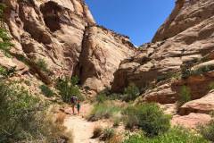
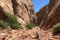
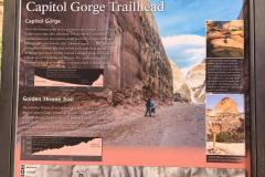
The parking lot at the end of the road is often quite crowded; arrive early or late in the day to secure a spot. Two trails take off from the Capitol Gorge Trailhead: a steep, moderately strenuous climb to a viewpoint of the Golden Throne and the easy stroll through the gorge. The Capitol Gorge hike begins at the covered picnic area at the road’s terminus and strikes out east into the slender canyon.

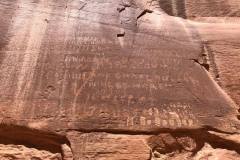
Follow the wide and sandy track for around ¼ mile the trail does indeed drop into the wash bottom, where most of the remainder of the hike will stay. Scan the right-hand wall for a peculiar sight of the Pioneer Register of a jumble of names and dates. From here, Capitol Wash slices through the Navajo sandstone, carving a canyon that thins to as little as 15-20 feet wide in several places. The etchings continue—and pick up in frequency—as hikers approach the Pioneer Register, a jumble of names and dates on the left-hand wall roughly 6/10 mile from the trailhead.

After the register, two minor ravines enter from the left and right, followed within minutes by another pair of larger side canyons. To the north is Tanks Draw, which hosts a series of waterpockets accessible by a short spur trail.

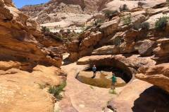
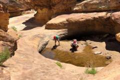
The side trip to the Tanks is well-marked and begins approximately 8/10 mile from the trailhead. The trail is rocky and rugged and climbs more than 100 feet over the course of ¼ mile, ending at an attractive drainage boasting—at most times—a half-dozen potholes full of water. The Tanks support one of Capitol Reef’s most interesting microenvironments—check for tadpoles and fairy shrimp, as well as lichens and mosses. The kids loved them and didn’t want to leave! However, when we were there their was only 1 tank with water and it barley had any. Somehow there were tadpoles still living and flourishing in it!

LOCATION

From the Visitor Center, drive south on the Scenic Drive for eight miles, turning left onto the unpaved Capitol Gorge Road. There are spectacular views from the road itself as it hugs the canyon walls. 

GPS COORDINATES

  • 38.2095986, -111.1694514

GEAR CLOTHING WE NEEDED

With climbing up and down on sandstone it’s best to have good grip hiking shoes or sandals. Here are our favorites.

During those warm summer months just make sure to bring sun screen, a hat, and always extra water. We always like our Days packs with our hydration bladder. Here are a few of our favorites.

CAPITOL REEF GALLERY

FUN FACT:

On the walls before the Pioneer Register are the names of six surveyors near the top of the vertical face—Stewart, Stewart, Hayes, Hurst, Ollrton, Gifford—and the date: September 24, 1911. How—and why—did these adventurous contractors carve their names so high up the canyon wall? The story told today involves what amounted to a pioneer prank. The six contractors conceived an idea: lower one of the members down from the top in a bucket to carve the names, then return a few years later with their families, to whom they would explain with astonishment—lying that they once etched the names standing in the wash bottom—“look at how much the canyon has eroded!” Whether the trick achieved its desired effect remains a mystery.

BACK TO:

Click here to return to our Complete Guide to Capitol Reef National Park

RECENT POSTS:

GRAND WASH NARROWS TRAIL

GRAND WASH NARROWS TRAIL

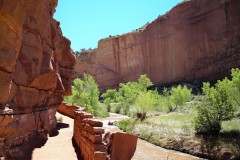
The narrows section of this canyon is short, only about half a mile long. But it is spectacular, and reminds many visitors of a miniature version of the famous Zion Narrows.

We have attempted this trail twice. Once was when the kids were younger and it was a hot summer day around nap time, and they just weren’t having it. We started on the west side and turned around a mile in. It was just one of those days. So we came back a few years later and attempted it from the East side and made it to the Narrows! A little past the narrows. We figured we already did the West side so we turned around and make it a 4 mile hike instead of a 6.

I would say that the East side is the best place to start, and then you can turn around at the Narrows and if you’re feeling good go and Hike Cassidy Arch as well! Sounds like a good day and then you can go rest at camp or enjoy a nice pie or some fresh fruit from the orchard in the fall.

LENGTH:

  • 4 – 6.25 Miles round trip. we went a little beyond the Narrows and then turned around.
  • You can hike back the way you came once you reach Cassidy Arch and the Scenic Road. But there are alternatives, such as having a shuttle waiting at the trailhead on the Scenic Road, or hiking up the Cassidy Arch Trail, onto the Frying Pan Trail, and down into Cohab Canyon. This route would drop hikers back on Highway 24, but 2.84 miles west of the northeastern Grand Wash trailhead.

TRAIL DETAILS:

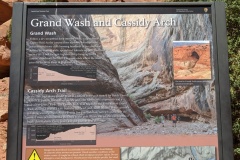
Grand Wash is a famous gorge that cuts its way through the upper portion of the Waterpocket Fold in Capitol Reef National Park. The wash connects the Scenic Road as it heads south past Cassidy Arch, to Highway 24 just east of Spring Canyon. The wash is level throughout almost the entire route, though it is full of streambed sediment. Only at the narrow does the trail close in and get tight.

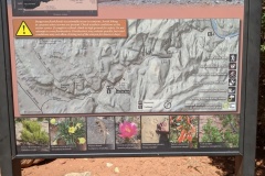
  • GRAND WASH NORTHEAST TRAILHEAD The northeast trailhead is actually the lower end of the canyon, and empties into the Fremont River. The northeast trailhead is just over 300 feet in elevation lower than the southwest trailhead, meaning that there is very little of a noticeable slope throughout the hike.
  • GRAND WASH NARROWS The narrows section of this canyon is short, only about half a mile long. But it is spectacular, and reminds many visitors of a miniature version of the famous Zion Narrows.
  • CASSIDY ARCH TRAIL JUNCTION Cassidy Arch is a large, well-formed arch along the rim of the Waterpocket Fold, just above the junction of Grand Wash and the Scenic Road. The trail takes hikers up above the arch, or onto the Frying Pan Trail, a hike that treks cross-country over the Fold, and down into Cohab Canyon.
  • GRAND WASH SOUTHWEST TRAILHEAD The trailhead is not directly on the junction of Grand Wash and the Scenic Drive. There is a parking area about 300 yards up the wash, just before the trail gets lost between the gargantuan rock walls that loom up above it.

LOCATION

Right off of State Route 24 – 3 miles west of the Visitor Center.

GPS COORDINATES

  • N38 15.829 W111 12.939 — 0.0 miles : Grand Wash Trailhead
  • N38 15.932 W111 12.798 — .2 miles : Cassidy Arch Trail split
  • N38 16.297 W111 12.331 — 1.0 miles : Level travel in sandy wash
  • N38 16.331 W111 12.089 — 1.3 miles : Enter ‘Narrows’ section of canyon
  • N38 16.540 W111 12.028 — 2.0 miles : Lower canyon opens
  • N38 16.691 W111 11.549 — 2.5 miles : Trail ends on Highway 24

GEAR CLOTHING WE NEEDED

With climbing up and down on sandstone it’s best to have good grip hiking shoes or sandals. Here are our favorites.

During those warm summer months just make sure to bring sun screen, a hat, and always extra water. We always like our Days packs with our hydration bladder. Here are a few of our favorites.

CAPITOL REEF GALLERY

BACK TO:

Click here to return to our Complete Guide to Capitol Reef National Park

RECENT POSTS:

HICKMAN BRIDGE TRAIL

HICKMAN BRIDGE TRAIL

A towering 400-foot-tall sandstone pillar, located three miles west of the visitor center off Highway 24 and accessible via a short hiking trail.

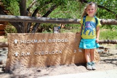
The trailhead to Hickman Bridge gives you three hiking options, depending on how much time and energy you have.

LENGTH:

  • The 1.8-mile round-trip walk to Hickman Bridge takes about 1.5 hours, the 4.6-mile round-trip hike to the Rim Overlook (on the Navajo Knobs trail) takes three to four hours, and the 9.4-mile round-trip hike to the Navajo Knobs takes six to eight hours.

TRAIL DETAILS:

The trail to all three of these destinations starts along the Fremont River and then heads down into a wash with a great view of the park’s namesake Capitol Dome.

After 0.2 miles you’ll reach the Hickman Bridge/Navajo Knobs junction. To see Hickman Bridge, a natural sandstone arch, go left. The trail gradually climbs 400 feet through a landscape defined by tall tan rock walls, junipers, cottonwoods, and ancient sand dunes. There are some artifacts of the Fremont people, like the remains of a pit house and of a granary, that you can check out along the way. The trail then comes to a junction, and you can go in either direction to circle beneath the bridge. The Hickman Bridge, which was shaped by flowing water, stands an impressive 125 feet high and is 133 feet long. 

LOCATION

Right off of State Route 24 – 3 miles west of the Visitor Center.

GPS COORDINATES

38.288780, -111.227650

GEAR CLOTHING WE NEEDED

With climbing up and down on sandstone it’s best to have good grip hiking shoes or sandals. Here are our favorites.

During those warm summer months just make sure to bring sun screen, a hat, and always extra water. We always like our Days packs with our hydration bladder. Here are a few of our favorites.

CAPITOL REEF GALLERY

BACK TO:

Click here to return to our Complete Guide to Capitol Reef National Park

RECENT POSTS: