

Talk about a little hidden gem! If you don’t like crowded parks, this is the place for you! I feel it has a little bit of Bryce, Capitol Reef, and Goblin Valley all mixed into one!
We stumbled upon this trying to find BLM camping on the Campendium app (which is great by the way!) and decided to stop in for a half-day. As always we stopped by the visitor center and asked them what was the best thing to do, and they referred us to ANGELS PALACE HIKE, so that’s exactly what we did!
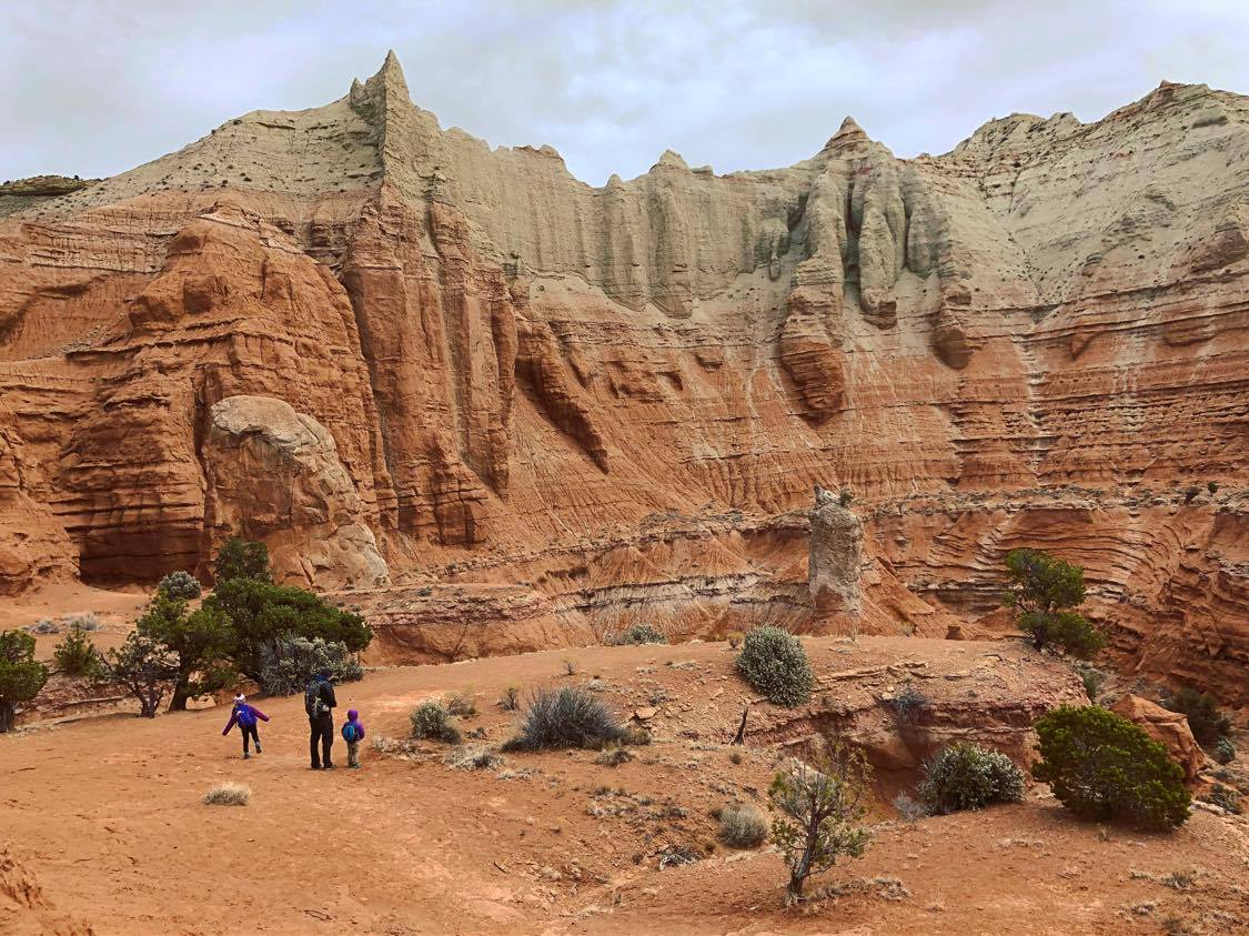
ANGELS PALACE HIKE:
LENGTH:
- 1.5 miles – 120ft elevation gain
- Easy/moderate
- Loop
TRAIL DETAILS:
The wide, sandy path remains mostly level at first as it enters a small canyon lined with orange sandstone. At the head of the shady ravine, the trail begins its 150-foot climb, first by gradually ascending the left-side wall, then switchbacking over to the right.
The trail flattens out as it nears the top of a ridge, following the north-facing slope. A short spur trail diverges from the main route and climbs to the end of a pencil-thin trail. Not for the faint-hearted. This vantage point offers splendid views of the basin below. After soaking in the vistas, return to the main trail and continue east across the sand and gently-sloping slickrock to the loop section of the hike. The first overlook on the loop is similar to the prior one, though you are now a bit closer to the throng of buttes and spires off to the south. The Gray Cliffs, rising around 800 feet from the basin floor, dominate views to the east. The final leg of the loop climbs rather steeply up a small ravine to reconnect with the original out-and-back trail. It’s a fun and easy hike for kids! We really loved all the views and enough diverse terrain so the kids don’t get bored! So that’s always a plus!
WEATHER

COST
Only $10 per vehicle! Check the official website for updated fee information.
LOCATION
Kodachrome Basin State Park is located about 40 miles SE of Bryce Canyon.
The Angel’s Palace hike begins and ends one mile north of the Kodachrome Basin Visitor Center. Park on the left-hand side of the road near the entrance to the shady Nature Trail, but cross the street to the east side to begin the Angel’s Palace Trail.
DIRECTIONS:
Approximately 300 miles south of Salt Lake City.
Nine miles south of the town of Cannonville off of Highway 12.
Address: PO Box 180069 Cannonville, UT 84718
GPS COORDINATES
KODACHROME BASIN STATE PARK: 37.5178° N, 111.9940° W
GEAR CLOTHING WE NEEDED
.
KODACHROME BASIN GALLERY


WHERE TO CAMP:
Kodachrome Basin State Park has two great campgrounds to choose from.
Amenities: Fire rings and tables at each site, vault toilet, water tap. Showers available at Oasis Group Site or Basin Campground.
Basin Campground (Closed December 1 to March 1)
- Basin campground is nestled right at the head of the basin and offers views of one of the many sandpipes that the park is known for and you are surrounded by large white hills and are within a short walking distance to access most of the hiking trails.
- Flush toilets and hot showers located in campground
Bryce View Campground (Closed November 1 to March 1)
- Bryce View Campground offers just exactly what the name implies. Great views of the pink ledges of Bryce Canyon in the distance and in the forefront, spectacular views of sandpipes and sandstone. This campground offers a great view of the sunset as well.
- Location: Gravel road access 1/4 mile past Arch Group Site.
BACK TO:

ADVENTURES IN UTAH


