

Description
This was our number one hike we wanted to do. the first time we tried it was closed due to no visibility, snow and ice. We waited 8 days and blue skies showed up just in time.
LENGTH:
Choose your distance if out and back. We went in 2 miles and turned around, so we went a total of 4 miles, and felt like it was an amazing hike! Going this way, the hike was easy and not strenuous, however, if you do the full loop of 11.8 miles it is very strenuous with an elevation gain of 1950 feet.
TRAIL DETAILS:
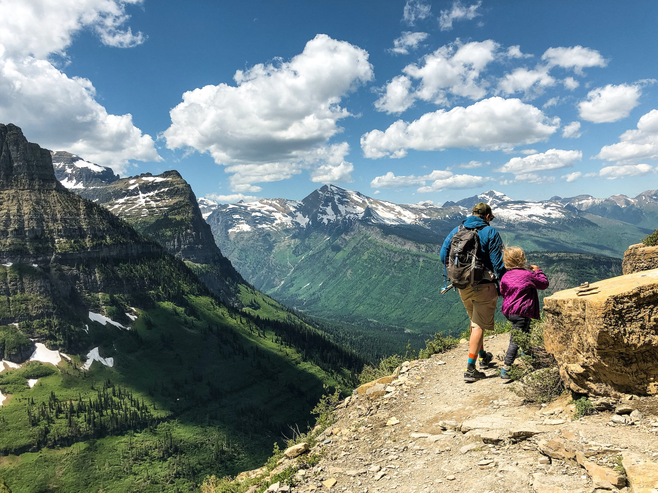
The Highline Trail shoots north along a cliff on the western side of the Continental Divide. The trail is carved into a sheer rock face known as the Garden Wall. Below the trail is a vertical drop to Going-to-the-Sun Road.
The trail is wide enough for hikers to pass in both directions, and there is a chain to hold on to through a precarious stretch near the start of the hike. Keep an eye out for wildlife! We saw bighorn sheep, marmot, and cute ground squirrels.
You’ll also cross seasonal waterfalls fueled by snowpack runoff, and enjoy constant westward views toward impressive summits like Mount Oberlin. The level rocky trail allows steady progress for the first three miles leading to the base of a rise protruding from the Garden Wall named the Haystack. We stopped here but this trail continues on for another 10.5 miles that takes you to the Many Glacier Region.
One day we’ll tackle this… It’s always fun to have something to look forward too.
WEATHER

COST
Effective June 1, the park entrance fee will be $35 per vehicle or $30 per motorcycle. An annual park pass will cost $70.
The Trail doesn’t require any permits if you are not backpacking and just day hiking.
Check the official website for updated fee information.
LOCATION
You can find the trailhead at Logan Pass, just across Going-to-the-Sun Road from the park visitor center.
DIRECTIONS
To get to the trailhead: Highline Trail starts at Logan Pass on Going-to-the-Sun Road at the Continental Divide. The Loop is located 7.75 miles down the same road west side of the divide. The free park shuttle stops at both locations.
GPS COORDINATES
Trailhead coordinates: 48.696343, -113.7176
GEAR CLOTHING WE NEEDED
.
GLACIER’S HIGHLINE TRAIL GALLERY


BACK TO:

ADVENTURES IN MONTANA


