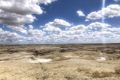
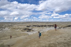
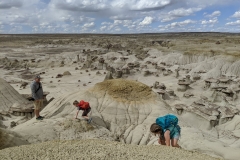
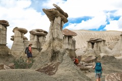
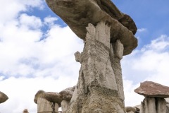
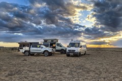
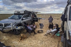
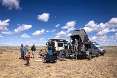
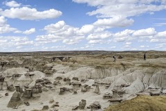
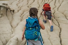
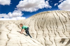
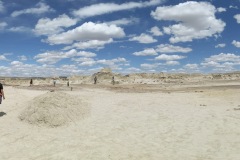
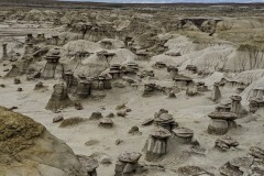
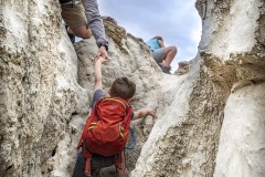
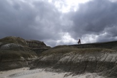
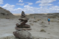
Ah-Shi-Sle-Pa is a hidden gem located off a long dirt road in the deserts of New Mexico a little south of Farmington. Its the kind of hike my kids never complain about. It’s an adventure playground with no marked trails, just free roam wherever your heart or kids desire. It’s fun to let them take the lead and see where they lead you! Climbing, running, jumping, hide and go seek, you name it and we did it.
LENGTH:
2+hours
The Valley of Goblins, the most well-known attraction, spans nearly 3 square miles that can be explored at your leisure. Beyond that area, the park also offers 6 miles of hiking trails as well! We haven’t explored those yet but would love to one day.
TRAIL DETAILS:
You can hike anywhere along the road to the badlands area and just drop in and start exploring the hoodoos. It’s also covered in petrified wood! The landscape is truly out of this world. It reminds us of Goblin Valley in Utah.
THING TO KNOW BEFORE YOU GO:
- Do not rely on Garman, Google Maps or Map Quest to get you to the parking area
- There are no facilities, come prepared
- This is a true wilderness area, there are no marked trails
- Bring lots of water
- Good hiking shoes are a must
- Cell phone reception is spotty
- There is little to no shade, be careful when hiking in high temperatures
- Check the weather before visiting, roads and terrain may become impassible in wet weather
- Watch for snakes
- Watch for flash floods in the wash
WEATHER

COST
FREE! No cost to enter the area or hike.
LOCATION
About 63 miles south of Farmington New Mexico or 50 Miles south of Bloomfield. The Best way is to put the GPS Coordinates into your google maps. It will take you right there.
DIRECTIONS
There are three main routes used to reach Ah-Shi-Sle-Pah WSA. One is from NM 371 in the west – along county road 7650 for 7.7 miles, south on 7870 for 9.5 miles then northeast on 57 for 2.8 miles. The BLM trailhead used to be at the end of an unsign posted half-mile track that forks off northwards, the junction being a short distance west of a lone house to the south, but the track has recently been closed to vehicles, which now have to be left along road 57. Like many of the dirt roads in this area, these three routes are used by trucks from the nearby oil fields so are kept in a good state of repair. The other two approaches are from the east, both starting from US 550; most direct is via road 57, which forks off the highway at Blanco Trading Post and reaches the trailhead track 18.3 miles later, after quite a few junctions (all clearly signposted with the road number). The first few miles used to be paved but now the surface is heavily eroded and quite bumpy – driving is easier on the hard-pressed dirt after this, though the road seems rather less used by oil trucks and more by the Navajo, so is not quite as good as others around. The third route is 451/7800 from Nageezi – fully paved for a few miles but wide and well used for all the 12 miles to the junction with road 57, 3 miles from the trailhead.
GPS COORDINATES
TRAILHEAD: 36.141, -107.927

GEAR CLOTHING WE NEEDED
.
AH-SHE-SLE-PA GALLERY
BACK TO:

ADVENTURES IN NEW MEXICO
RECENT POSTS:
- Weekend Explorer Camper Van

- Weekend Explorer Van with SOLAR

- Weekend Explorer Upgraded Flooring

- Drop Down Kids Bed Camper Van

- Mobile Boutique Van

Our favorite thing about this park is that its free range – no trails. You can go and explore and play all day. It’s huge so even though the parking lot might seem busy, once everything gets spread out and you head out past the main area then you have the whole place to yourself. It’s really neat to

Coming soon…ish – We’re gathering our thoughts, notes, and videos so we can create a guide that gives you information on things we did or wished we would have done.
THE GUIDE WILL INCLUDE:
- ADVENTURES
- HIKES
- EXCURSIONS
- SCENIC DRIVES
- VIEW POINTS
- NATURE WALKS
- ETC.
- CAMPING
- CAMPGROUNDS
- WILD (Free BLM Land)
- WEATHER
- GEAR WE USED/ NEEDED
- ANIMAL AND PLANT LIFE
- AND MORE
However, no matter how much we wish we could do everything, it’s just not possible. Amazing places always leave you with wanting more. We will provide you with links to the destination’s main site. There you can add your own interest into your itinerary as well.
NEED HELP NOW:
If you can’t find what you are looking for or if you are are planning your adventure and need help NOW. Reach out to us. We would love to seed you some quick information off the top of our head to get you started.
Ways to reach out:
- DM us via Instagram: @overlandforgood
- Email us at keri@overlandforgood.com
- Through here on our REACH OUT page
You can also check out our resource pages on planning an adventure. Especially How to Find Campgrounds Around your Destination.
ADDITIONAL INFORMATION:
In the meanwhile, you can view any of our recent posts. Check out our learning posts that gives you tips and tricks as well as free printable packing list and meal plans. Double check your gear and view what we use on our gear and vehicle mods pages, or even just get to know us.
Thanks for being patient as we continue to build these guides of where we have been over the past 15 years and where we are now.
WHERE WE ARE NOW:


