

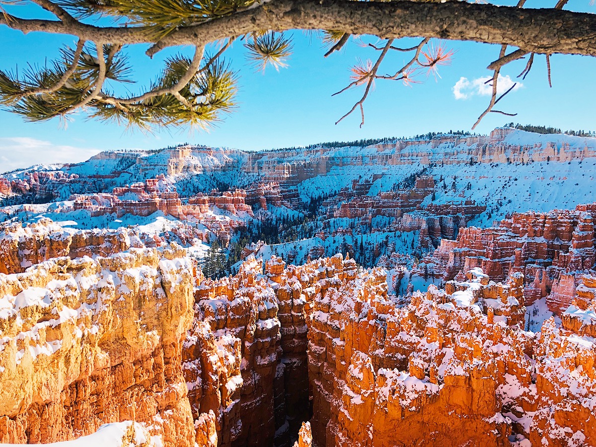
Get up close with the hoodoos, see Thor’s Hammer, and walk through canyons, arches, and forest of pines. One of the most unique places we have visited in Utah. A place you’ll never forget.
LENGTH:
2-3 Hours
2.9 miles round trip, 620ft elevation gain
TRAIL DETAILS:
Start at Sunset Point. Hike north (left) along the canyon rim until you reach Sunrise Point. From there follow the Queens Garden Trail to a 4-way intersection down at the bottom of the canyon. Continue straight ahead into the Wall Street half of the Navajo Loop which will return you back up to Sunset Point.
WEATHER
We’ve visited Bryce National Park in January, March, July, and October. The best times to visit are the spring and fall for the perfect weather, however, crowds are high as well. This trail would be difficult to hike in the winter, but we were able to go a little farther, but we wished we would have brought our snow shoes to finish it!

COST
Bryce Canyon National Park normally charges $35 per car/person upon entrance.
However, you can also purchase the Annual Pass for $80 to get into all USA National Parks if you are exploring more in a year’s time. You can purchase these passes onsite or we usually get our from a local REI as well! These are GREAT gifts you know explorers!
LOCATION
Goblin Valley State Park is located on Highway 24 in southeastern Utah, not too far from Arches, Canyonlands and Capitol Reef National Parks.
DIRECTIONS
The Queens Garden Trail starts at Sunset Point! Just follow the signs when you get into the park and you can’t miss it.
GPS COORDINATES
Trailhead: 37.62268, -112.16594
Trail End: 37.62843, -112.16294
WHAT WE NEEDED
Pack plenty of drinking water, snacks, and a picnic. Check the forecast and dress for the weather. Wear sturdy shoes with some traction. Don’t forget the sunscreen!
QUEENS GARDEN & NAVAJO LOOP GALLERY


BACK TO:

ADVENTURES IN UTAH


