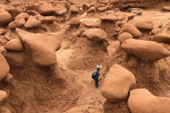
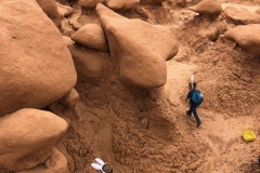
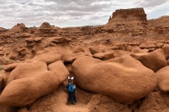
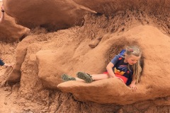
Maligne Canyon is the deepest canyon in the Rockies! It looked and felt like we were in the Pacific Northwest surrounded by mist and covered in moss.
Maligne river, that originates at Maligne lake flows underground from Medicine lake, until it reaches Maligne Canyon. At the canyon, carved into the Palliser Formation — a layer of limestone deposited in a shallow tropical sea by lime-secreting plankton, the underground streams join force, to become the mighty flowing water that still whittles the canyon away. Maligne canyon has a depth of more more than of 50 m at certain points.
It was so neat to be able to see. It’s a great “hike” for kids. All the walks are paved and really nice. It was overcast and raining while we were there so the walks were a little slick. The farther you go in the steeper the walks get, it was even more beautiful and green in person.
LENGTH:
- Distance 3.7 km (from the Sixth Bridge one way) 2.3miles
- Allocate 1 to 3 hours.
TRAIL DETAILS & GPS COORDINATES:
Depending on your time and agility, you can choose from a variety of hiking options. There are three ways to access Maligne Canyon.
- From the main parking lot near the tea house and the Hi Maligne Canyon Lodge, which gives you access to the first bridge. GPS : 52.920728,-117.999004
- From fifth bridge. GPS: 52.9214565, -118.0168955
- The sixth bridge. If you start from here, you will be doing the full loop. GPS: 52.933431,-118.030225
The spectacular canyon views are near the first and second bridge. There are trails on either side of the canyon. The tallest waterfall is near the second bridge. If you are short on time, cross the first bridge, walk along the canyon ridge and then cross back at the second bridge and turn back.
If you want to see the Maligne Canyon at its best, go till fifth bridge (at least till fourth if short on time). 4.4 km return with 100 m elevation gain.
The advantage of hiking up from fifth or sixth bridge is that you will be able to avoid the crowds in high season.The distance from the fifth bridge to sixth bridge is ~1.6 km. This is a shared trail (bike + horseback riding)
The trail head to 2.1 km flower loop and the 15.5 km(one way ) Overlander trail starts at the sixth bridge.
THINGS TO DO:
- Hike down the canyon from the parking lot near the tea house and observe the natural rock formations and large dry potholes.
- Walk along the rim of the canyon to the subsequent bridges, reading the interpretive displays: Enjoy a lesson in geology.
- Marvel at the deep canyon, the water falls and the power of the churning, swirling river that created it, from the first and second bridges. Notice the water that disappeared at the Medicine Lake flowing into the Maligne Canyon through the underground cave system from the fourth bridge.
- Observe the mosses, the lichens on the canyon walls . Try to spot American dipper as it swoops down to feed on underwater insects, check for Black swift and raven nests on the canyon walls.
- Observe the river becoming wider and the river gaining in water volume by the time you reach the sixth bridge (due to more water from underground lakes), near the junction of Maligne and Athabasca river.
- Enjoy Aurora-gazing / stargazing at Maligne Canyon during Jasper Dark Sky Festival – 2016 Dates: October 8, 15 (moon viewing), 19, 22, 29 | 10:30 PM
LOCATION:
Maligne Canyon sits at the gateway to Jasper’s Maligne Valley, just minutes from Jasper and home to some of region’s most breathtaking scenery and iconic adventures. Named for its haunting atmosphere, Maligne Canyon is the deepest canyon in the park, dropping to a depth of more than 50m at some points. Six bridges built across the canyon allow hikers of all abilities to explore this incredible natural landmark.
DIRECTIONS:
To get to the Maligne Canyon Trailhead, follow Highway 16 towards Edmonton; go 1.8 km past the east Jasper exit to the Maligne Road. On the Maligne lake road go 2.1 km and then turn left at the Sixth Bridge sign. If you want to shorten the hike a little you can turn left at the fifth bridge(at 2.9 km), or just go straight to the Maligne Canyon itself(at 6.1 km). *The hike from the sixth bridge would be considered a must from our point of view.
MALIGNE LAKE GALLERY
no images were found
OTHER FUN THINGS TO DO:
Ice walk tours:
- Jasper adventure centre : 3 hours : Rate/ Price : Adult: $65.00 & Child (under 12): $29.00
- Maligne Adventures : 3 hours – Rate/ Price:$65.00 +GST; Youth (7-14): $32.50 + GST. GST extra. Not recommended for children under 7.
- Sun dog tours : 3 hours – Adult: $65.00 & Child (6 -12): $29.00 + GST. Not recommended for children under 6.
Maligne Canyon Ice Walk on Your Own (DIY)
If planning to do the Ice walk in Maligne Canyon on your own, get waterproof snow boots and fit it with ice cleats/crampons/micro spikes. Plan for two hours. Please make sure that you are in a group. It is good to do it on a guided tour.
- Park at the parking lot near the tea house and walk till the fifth bridge, enjoying the frozen waterfalls and ice sculptures on the canyon rim as you peer down the canyon from the rim. The winter hiking trail for Maligne canyon ice walk starts near the fifth bridge. Follow the frozen river, and walk up the river into the canyon.
- Walk on the frozen river bed enjoying the astonishing natural ice sculptures, and frozen water falls. Watch the ice climbers making their way up. Turn back once you reach the third bridge. You can continue further, but it is safer to turn back at this point especially if you are alone.
- Another option is to park near the fifth bridge, and enter the canyon from here for the Maligne canyon ice walk.
BACK TO:
Click here to return to our Complete Guide to Banff and Jasper National Park
RECENT POSTS:


